Mumbai meri jaan!
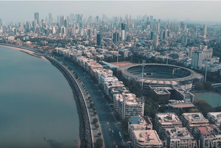
A phrase which typically every Mumbaikar has heard of or used at least once in their life. Well, Mumbai (formerly known as Bombay) is the financial capital of India and the most populous city in our country. It lies on the Konkan west on the west coast of India and has a population of approximately 20 million. The city has a large commercial and a trading base and is also considered as the economic powerhouse of our country. Mumbai is also instrumental in acting as the host for various industries, multinational companies and financial institutions.
THE MUMBAI FLOODS
26th July, 2005 – This day has been entrenched into the minds of every Mumbaikar for all the wrong reasons. Mumbai experienced a deluge that day which wreaked havoc in many parts of the city. The city had recorded 944 mm of rainfall in a period of 24 hours. Nearly 5000 people had lost their lives and a myriad of people were stranded and had lost their homes. Transportation, telecommunications, power and financial services were cut off. Several international and domestic flights had to be cancelled .The flood which had indeed paralyzed the city. Mumbai had come into a standstill.

Floods are a long term and a recurrent problem in Mumbai. Whenever there is a downpour, the city is most likely to get inundated and the aftermath seems to always be bleak. People have to wade through the roads, commuters get stranded and slum dwellers become homeless. The main question that arises in this scenario is why does Mumbai get drowned every year? Which factors seem to exacerbate the problem?
Well, the root causes of flooding are an obsolete drainage system, the destruction of Mangroves and unsustainable urbanization. To demystify the problem, it is necessary to delve deep into these factors and most importantly understand the root causes of WHY.
Outdated Drainage System
Mumbai’s drainage system is nearly 140 years old, clearly outdated and poorly maintained – which is why it is unable to cope with the barrage of water when the city experiences heavy rainfall every year. The two areas which are mainly considered to bear the brunt of the old drainage system are the central depression in Colaba and the surroundings of the Mithi River.
The 100 year old drainage system in Colaba is ruptured, which is why it frequently leaks into the drinking water pipelines. The pipelines in Colaba are completely battered and are far underground below sea level. The monsoon leads to the flooding of pipelines with water, which in turn gets mixed with street sewage water and ultimately results in street closings every year.
Mumbai’s storm water drainage system is heavily clogged and punctured at many places. The drainage system is a network of surface drains across 2000 km and underground drains of about 400 km. In many suburban areas of Mumbai, the underground drainage system has not yet been completed. The open sewers, throughout the area, have been completely obstructed with garbage and shut due to the construction of roads. Mainly this area serves as a home to the city’s most populous residents, i.e., the slum dwellers. (who reside on the banks of the Mithi river). Truth be told 70 percent of the Mithi river’s embankments are occupied by informal settlements.
Hence, the encroachment of people and mainly the concretization of open spaces has thwarted the percolation of water, eventually leading to water logging.
DESTRUCTION OF MANGROVES
The destruction of Mangroves is also one of the major causes for the extreme floods in Mumbai. The mangrove ecosystems which exist along the Mithi river and Mahim creek are being destroyed in the garb of infrastructure development in the city.
The mangroves play a significant role in absorbing the excess water, thus acting as a natural defender against the impact of climate change.
It has been estimated that Mumbai has lost 40 percent of its mangrove forest cover between 1995 and 2005, which is undoubtedly hazardous to nature. It has also been calculated that Mumbai’s mangrove cover has been shrunk by 15 – 20 percent in the last five years due to the ”dumping of debris and encroachment”. In 2019, the mangrove society of India had reported 75 cases of mangrove destruction along Maharashtra’s coast line. A significant part of these cases had come from the Mumbai Metropolitan region.

The fundamental issue over here is that there is no replacement for the number of lost mangroves in the city. The importance of mangroves has been blithely ignored by calling it a ”waste land”. In fact, the INORBIT MALL in Goregaon and Malad has been built by destroying a substantial amount of mangroves in the city.
RAPID URBANIZATION AND PLASTIC POLLUTION
Urbanization puts the nature in peril. The construction of flood plains, airports and metro projects are being done for the advancement of the city but at the cost of nature. Urbanization leads to excessive accumulation of water on roads, railway tracks and this problem further aggravates because of the faulty drainage system. Urbanization has caused ”significant alterations to hydrology, morphology habitat and ecology of the city.”
Due to the construction of the CSIA (Chhatrapati Shivaji Maharaj International Airport) runway, the course of the Mithi river has been changed. Hence, during excessive rainfall the water which has been running with a great deal of pressure instead of deviating, its path climbs above the land surface, thus turning the area into a swamp.
The construction of the Bandra Worli sea link has also been accountable for the floods in the city. The sea link has narrowed down the mouth of the Mithi river at the Mahim bay. As a result, during high tides when the water from the river is being discharged into the bay (since the mouth has been constricted) the water gushes back and overflows from the bank, hence leading to flooding.
Plastic pollution is also one of the core problems that needs to be taken notice of. ”Mumbai generates around 700 metric tonnes of plastic waste per day”, which ends up in the blockage of drains. Especially the area around the Mithi river has been completely obturated with plastic. The chunk of plastic collected is a matter of major concern and to mitigate flooding, this issue needs to be addressed as soon as possible.
DEVASTATING IMPACT OF FLOODS
Floods are undoubtedly a catastrophic event. The destruction caused by this event goes beyond measure. Innumerable lives are lost, people become homeless, and there are various other socio economic impacts. The ramifications of this event have been discussed below in detail.
Impact on Slum Dwellers
The section of slum dwellers in the city have to bear the brunt of this disaster. Due to the dearth of basic amenities in their life, such as poor infrastructure, unhygienic sanitary conditions, they easily become the most vulnerable section of our society.
Poverty being the core issue, they usually reside in chawls or the land close to the streets. When the land gets inundated, their houses get easily washed away, thus leaving them homeless. This leaves them under huge monetary pressure and ultimately sabotages their lives. The aftermath of the floods leaves them at a high risk of water borne diseases such as malaria and dengue. That too amounts to another monetary burden on them in terms of cost of treatment.

IMPACT ON ECONOMY
Floods have a significant impact on the economy of a country. The following table gives a detailed account of the impact of floods in our country from 1973-2006.
| YEARS IN GROUP | Average area affected in ‘000 hectares |
Average human loss in ‘000 |
Average cattle loss in ‘000 | Average economic loss in million rupees |
| 1973-77 | 9606 | 3022.2 | 186.2 | 2542 |
| 1978-82 | 9588 | 2379 | 249 | 6382 |
| 1983-1987 | 9162 | 1775.6 | 105.2 | 17540 |
| 1988-92 | 8531 | 2109 | 96 | 14928 |
| 1993-97 | 6821.4 | 1992.2 | 73 | 16090 |
| 1998-2002 | 5382.5 | 2143.25 | 59.03 | 16863.3 |
| 2003-06 | 2867.5 | 1563.75 | 34.14 | NA |
STEPS TAKEN BY THE GOVERNMENT TO CURB THE FLOODING.
The Brihan Mumbai Storm Water Disposal System
After the deluge in 2005, Mumbai had launched a project named Brihan Mumbai Storm Water Disposal System to overhaul Mumbai’s drainage system. The initial cost of the project was around Rs 6 billion.By 2005 the cost of the project had shot up to Rs.12 billion.
Since the project has an enormous budget, it requires funds from the central government. In 2007, the center authorized Rs. 1,200 Crore for it. As of July, 2019 Rs.10,000 Crore has been spent on the project. The BRIMOSTWAD project aims to increase the capacity of the drains from withstanding 25mm to 50 mm of rainfall, thus preventing water-logging.
Despite the project there haven’t really been changes in the way Mumbai has combated the floods. It hasn’t seem to gotten better with time. Every year, the city submerges itself thus coming to a shrieking halt. Now, this raises a huge question on the implementation of the project. Are the funds being utilized properly? Are the procedures being followed properly?
Well, it turns out that the project is yet to be completed. ”It comprised of 58 works, including rehabilitation and augmentation of underground drains, widening and deepening of nullahs and construction of pumping stations.” The civic body has only completed 38 works.
Why has there been a delay despite spending such a colossal amount of money?
The civic authorities have cited many reasons for its delay such as encroachment and litigation. The problem has intensified because of the combination of reclamation and construction. The construction materials, the waste matter are occluding the drainage system, hence giving rise to water logging. Areas like Hindmata, Chembur, Dahisar and Mankhurd find themselves completely engulfed in water every monsoon.

Poor workmanship, dilapidated structures and ignorance to drainage repairs by utility providers have also been mentioned as reasons for the ineffective management of the drainage system.
Mumbai Disaster Risk Management Plan
Prior to the July 2005 floods, the Relief and Rehabiliation Division of the Government of Maharashtra had prepared a Disaster Management Plan (DMP). The Government of Maharashtra had developed India’s first urban disaster Management plan for Mumbai in the late 1990’s.Alongside the Maharashtra State DMP, the plan’s objective was to create and coordinate institutional networks, with little focus on Mumbai’s unique disaster risk context.
As rightly asked by Aromar Revi in his article, why wasn’t the plan enacted in a way that could have prevented the 2005 floods?
According to Revi, the city government had not coordinated to any of the response of the DMP which would have supported efficient city planning and risk mitigation. The government had not formulated or executed a blueprint for mending and maintaining the century old drainage system. Revi also mentioned that this plan of action encompassed of ”providing new housing options for slum dwellers living in flood prone areas or the creation of sound land policies to address the city’s overpopulation.” He further elaborated on the government’s lack of attention to the DMP. He elucidated about how the government had failed to support efficient planning and risk mitigation systems.
The government also failed to take note of the warnings of academic planners and architects in connection to Mumbai’s dangerous development path. The Brihan Mumbai municipal corporation had reported that the state needed to recondition the drainage system throughout the city. The BMC also complained that there are no available funds and unless and until other reforms, such as property tax and rent reforms don’t take place, the help provided by the multilateral agencies won’t do. Thus, the Disaster Management Plan was never fully implemented which consequently, gave fodder to the 2005 floods.
Integrated Flood Warning System – IFLOWS Mumbai
In 2020, the Chief minister of Maharashtra Uddhav Thackeray and Dr. Harshvardhan (Union minister for Health and family welfare, science and technology)launched an integrated flood warning system named IFLOWS- Mumbai.
WHAT DOES IT DO?
IFLOWS is a monitoring and flood warning system, that will be able to pass on alerts to the flood prone areas anywhere between six to seventy- two hours in advance. The system would be able to impart all the information regarding possible flood prone areas including:
i) the height the floodwater could attain
ii) location-wise problems areas across all 24 wards
iii) calculation on the vulnerability and risk of elements exposed to flood.
A joint initiative between the Ministry of Earth sciences (MoeS) and BMC, the system has been chalked out to generate flood warnings for specific geographical areas of the city. All the information would then be passed on to authorities. The early warning forecast would include alerts on rainfall, tide-levels, storm surge for low lying areas which are always the worst flooded areas. Through this system, the government aims to alleviate the damage from cyclones and heavy rains by cautioning the citizens to avoid the flood prone areas.
Hence after Chennai, Mumbai is the second system in the country to install this system. A MUCH NEEDED MEASURE!
WHAT DOES THE FUTURE OF MUMBAI LOOK LIKE IF THE SITUATION DOESN’T IMPROVE?
If the situation in Mumbai remains stagnant, that is getting inundated with flood water every year, then the city would be far from emerging as one of the most developed cities in the world. According to some climate change projections, 40% of greater Mumbai could be underwater by the end of the century, due to the ongoing sea level rise. It has also been calculated that the sea level rise is going to increase by between 24 and 66 cm for Mumbai. By the mid-century (2021- 2040), the monsoon rainfall for the Konkan administrative division of Maharashtra has been estimated to increase by between 10% and 30%.The annual mean temperature for the same period is projected to increase by 1.1 degree Celsius – 1.28 degree Celsius.
Increased salinity of coastal groundwater, the wetlands in peril and the loss of valuable land are some of the consequences of the rising sea levels. If the situation doesn’t improve, the total losses in Mumbai could triple by 2080 (ADB report). The floods would likely double, tripling the amount of losses thereby, amounting to $690-1890 million by 2080.
Every cloud has a silver lining. If we had to look at this situation with some ray of sunshine, then it could only be the resiliency of Mumbaikars, who come together at the time of distress and leave no stone unturned to limp back to normalcy.